Alpine National Park, Victoria, Australia (January 2021)
We chose to stay in Mount Hotham ski resort the night prior to commencing and had organised a taxi from Mount Beauty Taxi company at $350. While expensive, you are getting value – the pick up was at our request at Mount Loch at 8.30am on Sunday morning. Julie was our driver (co-owner) and she was there when we arrived at 8.15am. The journey takes approximately 2-2.5hours and so for the taxi company it is a five hour return trip! So when one looks at it this way, it is now expensive and if you get a group of four, it is not much more than the Falls Resort Transfer.
We chatted about all sorts of things as we transferred, the hike, preparation, weather, covid and kids, and before we knew it we were pulling into the Healthy Spur Track Head on the other side of the Falls Creek Village. If you want to go to the toilet before starting, ask the taxi to drop you off before you head across the dam wall as there are toilets here.

Once out of the taxi, we had a brief chat with some Rangers who were using drones to search for a weed (sounds random but apparently they are easier to spot in January / February when the weed flowers). After discussing the beauty of the wildflowers this year we were on our way, winding up and out of the parking area at about 10.40am. There are plenty of views as you climb away from the dam through low shrub and lots of flowers which slowly give way to the high plains and the shrubs decrease in size and you are walking a trail on the plain.

This section is mostly uphill (but not strenuous) until you hit the Great Alpine Way. This represents the point where you stop heading in the ‘wrong’ direction and start to head towards Hotham, so at about 5.5km into the day’s trek, it is nice to feel that you are starting to make ground on the campsite. In addition the track changes, the Healthy Spur Track was narrow with a dirt base and knee high grasses and shrubs, to a gravel road for about half a kilometre until you veer to the left and rise over a small hill before descending about 140m through the beautiful snow gums. The other difference about hitting the Great Alpine Way is that you find the snow poles which you will follow for most of the journey. These are all numbered and can be easily referenced on the map to determine where you are.

At post 681 you emerge from the gums to cross the aqueduct. This is a great spot for lunch (depending on what time you left). It is sheltered from the sun, flat and you are not going to accidentally prop your pack on an ants nest (I’ve done this a few times this trip). The other great lunch spot on this day is at Wallace’s hut as it has a picnic table and chairs and is also well sheltered. But this does depend which route you intend to take at the end of the day.

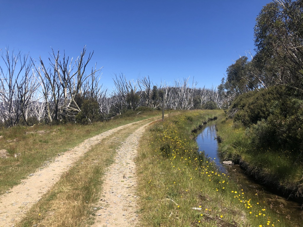
The walk is then very easy as you follow the Longfords Aqueduct for about 5.5km as you follow the sometimes open and flowing and sometimes covered aqueduct. I liked it best when the water was open and you could hear it gurgling and it is full of little fish that dart here and there.
The first hut you come to is an SEC hut, at this one you need to keep walking another 3.5km to the turn off to Wallace’s Hut.

This is a decision making point, the way marked from this direction, indicates that you should go via the hut, but if you are tired it is quicker by about 0.5km to continue along the aqueduct. We decided to see the Hut as it is one of the oldest Huts in the National Park. It was built in 1889 by the Wallace brothers (Arthur, William and Stewart) and is made from snow gum and woollybutt. Apparently the roof was replaced by the SEC when it was used as a worker’s hut around 1946. It also has its own little out house.
From the hut you will find Wallace’s Heritage Trail which commences just past the hut on left and takes you on a very small track that leads to the car park. We saw lots of people on this track, so it is surprising that it is quite grown over in small parts. The trip is about 2km until you hit the road.

From the road it is about 400m down to the left on a gravel road to Cope Hut. A further 100m to 150m you will see the little camp sign which signals a little path up to the right and onto the flat plain where the camp grounds are. There are a few paths around the hut and we took the one that went past the front of the hut and the toilet. There are five camping platforms which are numbered and line up with the one that you booked online. If you keep heading past the platforms you hit the grassy free camp area. Here we set up to enjoy our beautiful view and to go back to explore Cope Hut.

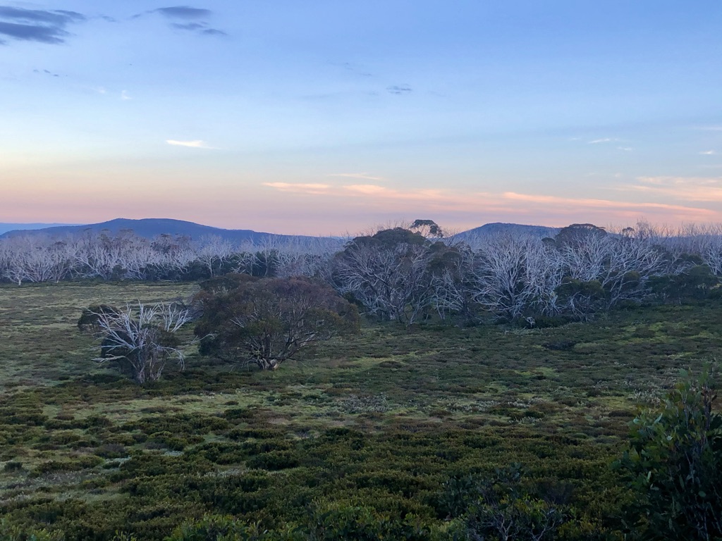
The following two photos show our view from our campsite in the day and at dusk – it is so pretty. It was quite a warm day, so we had used lots of sunscreen to protect ourselves, but it was nice when the clouds started to roll in. There was plenty of water along the aqueduct and the campsite here has one small water tank and one toilet (bring your own paper).


